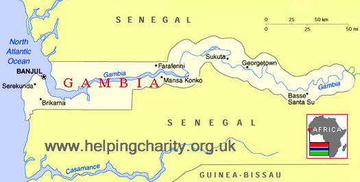


The Gambia is the smallest country in Africa and lies on the west coast, completely surrounded by Senegal. It is 500km long and no more than 30km wide, its long narrow shape mirroring the course of the River Gambia which runs through the entire length of the country.
Britain's links with The Gambia date back to Elizabethan times with documented trade links since 1588. Gambia was a British colony and its troops fought alongside the Allies in World War II. Independence was granted in 1965 and The Gambia remains a member of The Commonwealth with English as its official language, spoken alongside Mandinka, Wolof, Fula and other dialects.
Tourists attracted to its Atlantic coast beaches and vast variety of birdlife provide a valuable source of income and employment but the country remains poor with one third of the 1.8m population surviving below the international poverty line of 1.25 US dollars a day. Average life expectancy is 63 years.
Just one sixth of the land is arable and poor soil quality means the only crop which can be widely grown is the peanut, making The Gambia very vulnerable to changes in world peanut prices. The country is also burdened with high levels of debt, forcing it to rely on foreign aid and charities.